• EO Unlocked: Metadata Search Engine for Earth Observation

User-centric innovation for Earth Observation, seeking to increase market transparency through “big metadata” analysis. Uses space situational awareness data from Celestrak, propagated via SGP4, and made searchable using an R-Tree spatial index. Search and filtering GUI developed in React and ThreeJS with the use of Open-Meteo API for supplemental weather data. Sensor specifications for thousands of spacecraft mined from ESA’s eoPortal, the World Meteorological Organization’s “Oscar” Tool, Nanosats EU, and Gunter’s Space Page. The unstructured data was then synthesized and organized programmatically using the OpenAI API.

EO Unlocked Gif Representing Proliferation of Spacecraft

Simply select a location and historical timeframe of interest and receive instant results for predicted visual footprints of a virtual constellation of more than 350 spacecraft, ranked by cloud coverage.

Search Result from EO Unlocked given a lat,lon as well as a timeframe of interest

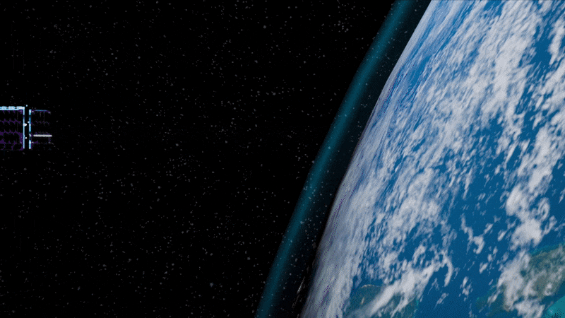
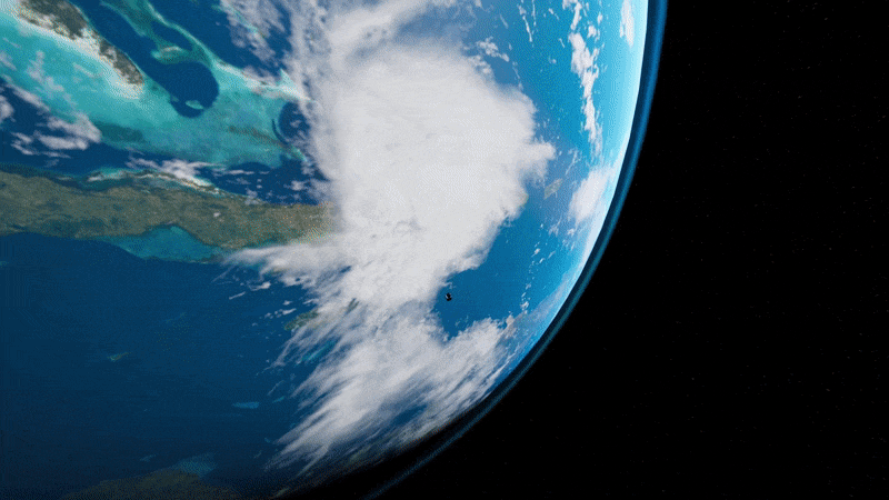
  • Light sail deployment simulation

Simulation of on-orbit free-flying light sail deployment from the Cornell Alpha CubeSat, developed and choreographed in Unreal Engine 4. Alpha will carry the world’s first retroreflective, solo-flying light sail—and become the trailblazer for future missions to our nearest stellar neighbor, Alpha Centauri.

Alpha Animation 1

Alpha Animation 2

Alpha Animation 3

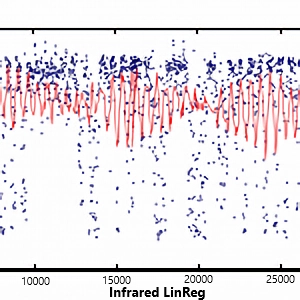
  • Detecting Cloud Cover from Space Using Infrared Sensors (Miami Young Data Scientists)

We had the opportunity to run our code on-orbit aboard Spire Global’s Lemur 2 NanoSatellite as part of a winning experimental machine learning entry in the 2015 Association of Space Explorers (ASE) Astrosat Challenge.

Render of Ardusat NanoSat

Winner Announcement: ASE Astrosat Challenge

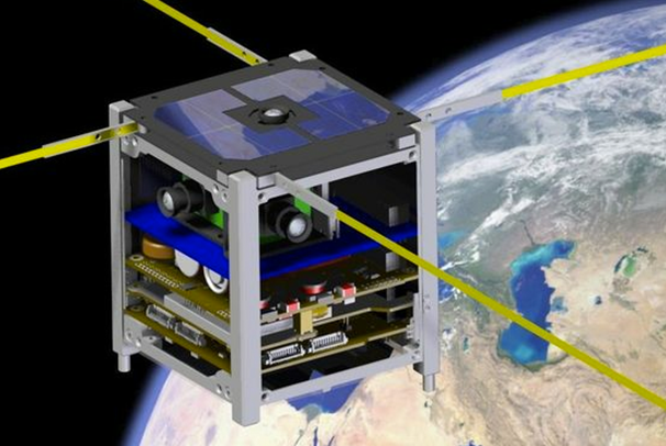
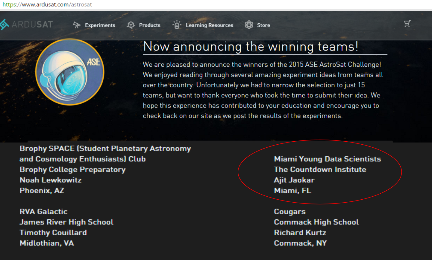
Data collection was constrained to 15 kilobytes, approximately 1500 observations, from an equatorial orbit. Used a support vector machine approach on infrared emissivity data to predict cloud cover, validated with live weather apis.

Experimental Code: Detecting Cloud Cover from Space Using Infrared Sensors

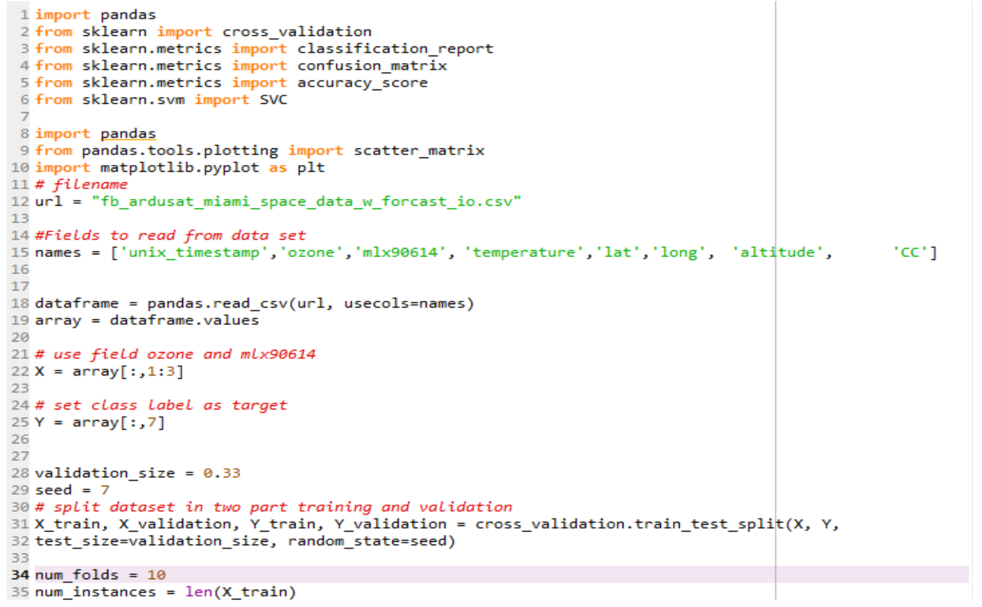
Achieved approximately 75% accuracy in the binary classification problem (is it a cloud or not?).

Countdown Institute Logo Data Output with Linear Regression Best Fit

My teammate and I delivered our findings to the local Miami tech community with the Countdown Institute and taught introductory space and data science to local students.

Ardusat Space Kit